
How an Elevation Certificate Helps When Road Flooding Keeps Coming Back
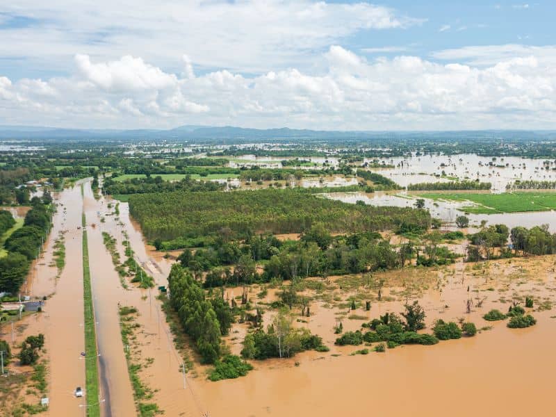
There’s a big difference between a street that floods once after a bad storm and one that floods every time it rains hard. Homeowners near roads that flood over and over start asking different questions than people who dealt with water just once. An elevation certificate becomes one of the most useful documents a property owner can have when flooding stops being a rare event and starts being a regular part of life in the neighborhood.
The First Flood Feels Different From the Fifth
The first time a road near your home floods, it feels like a weather event. You wait it out, the water goes down, and life goes back to normal. By the third or fourth time, it stops feeling like bad luck and starts feeling like a pattern, and that shift changes how homeowners think about their property.
People who deal with repeated flooding start asking harder questions. They want to know why it keeps happening, whether their home is at real risk, and what their options are if they want to sell or renovate down the road. Those questions don’t have easy answers based on memory alone, and personal experience only tells part of the story. What actually sits on record about a property’s ground level, and how that level compares to the base flood line in the area, is information that goes well beyond what any homeowner can see from their front yard.
Everyday Routines Start to Revolve Around the Weather
When a road floods often enough, people stop being surprised by it. They start checking the forecast before leaving the house. They learn which routes stay open and which ones don’t. Some families plan around it when deciding where to send their kids to school or where to work. The flooding becomes part of how they live, and that shift happens faster than most people expect.
That kind of adjustment is a sign that the flooding has moved from a problem into a condition. Once it becomes a condition, property decisions start to follow. A homeowner who plans to renovate a basement or add square footage to a flood-prone property needs solid information about the elevation of their home before they commit to anything. A buyer looking at a house on a street with a known flooding history will want the same. An elevation certificate gives both of them a documented, factual starting point that personal observation simply can’t provide.
Looking Beyond What Happened Last Week
After a bad flood, recent events tend to shape how people think about risk. If the water got close to the front door last month, that memory looms large. If the last few storms passed without much trouble, it’s easy to feel like things are fine. Neither reaction gives a full picture of what’s actually going on with the property’s relationship to flood risk in the area.
An elevation certificate doesn’t record what happened during the last storm. It records where the structure sits in relation to the base flood level set by official flood maps, and that number stays consistent regardless of how last season went. For homeowners trying to make decisions about insurance, renovations, or long-term plans for the property, that consistent reference point matters more than any single weather event. It gives owners a way to think about their property that isn’t tied to whatever the water did or didn’t do last week.
Questions Tend to Multiply Over the Years
Flooding that repeats over several years tends to raise more questions, not fewer. Early on, most homeowners want to know if they need flood insurance. A few years later, the questions shifted. Some start thinking about whether it makes sense to remodel, and whether a renovation near the flood zone will trigger new requirements. Others start thinking about refinancing or what a future sale might look like to a cautious buyer.
An elevation certificate supports all of those decisions, not just one. Some of the situations where it tends to come up include:
- Reviewing flood insurance options and whether current rates are accurate
- Planning a renovation or addition near a flood-prone area
- Refinancing a mortgage on a property in or near a flood zone
- Answering questions from buyers during a future sale
Having the certificate already on file when these situations come up saves time and avoids the scramble of trying to get one under pressure. The document stays useful long after the flood that first prompted the question.
Peace of Mind Often Comes From Better Information
Nobody can stop the rain or control where water goes after a heavy storm. What homeowners can control is how well they understand their own property, and that understanding starts with having the right information on hand. Guessing flood risk based on what the street looked like during the last storm is not a reliable way to make decisions about insurance, renovations, or the long-term value of a home.
An elevation certificate replaces that guesswork with a documented record of where the structure actually sits in relation to the flood maps that insurers and local building departments use. It doesn’t change the property’s risk, but it gives the owner a clear and accurate picture of what that risk looks like according to the official record. For homeowners in areas where road flooding keeps coming back, that kind of clarity is genuinely useful, not just during a crisis, but in all the quiet decisions that follow long after the water is gone.
Frequently Asked Questions
Why do repeated flooding events change how homeowners view their property?
When flooding happens once, most people treat it as a weather event and move on. When it keeps happening, owners start asking real questions about risk, insurance and long-term plans for the property.
How can an elevation certificate help after multiple flooding events?
It provides a documented record of the property’s ground level in relation to the official base flood line, which supports decisions about insurance, renovations and future ownership.
Is an elevation certificate only useful right after a flood?
No. It stays useful over time for insurance reviews, refinancing, renovation planning and answering questions from future buyers who want to know the property’s flood status.
Can road flooding affect the way people use their property?
Yes. Repeated flooding changes daily routines, travel patterns and how owners think about future improvements or plans to sell the property.
Does an elevation certificate eliminate flood risk?
No. It gives owners accurate information about where their property sits in relation to flood maps, which helps them make better decisions but doesn’t change the physical risk.