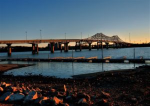
Welcome to Decatur Land Surveying

Welcome to Decatur Land Surveying

This site is intended to provide you with information on Land Surveying in the Decatur, AL and Morgan & Limestone Counties area of Alabama. If you’re looking for a Decatur Land Surveyor, you’ve come to the right place. If you’d rather talk to someone about your land surveying needs, please call our local number at (256) 445-8450 today. For more information, please continue to read.

Decatur land surveyingLand Surveyors are professionals who make precise measurements to determine the size and boundaries of a piece of real estate.  While this is a simplistic definition, boundary surveying is one of the most common types of surveying related to home and land owners. If you fall into the following categories, please click on the appropriate link for more information on that subject:

Decatur Land Surveying services:

    1. I need to know where my property corners or property lines are. (Boundary Survey)
    2. I have a loan closing or re-finance coming up on my home in a subdivision. (Lot Survey)
    3. I need a map of my property with contour lines to show elevation differences for my architect or engineer. (Topo Survey)
    4. I’ve just been told I’m in a flood zone or I’ve been told I need an elevation certificate in order to obtain flood insurance or prove I don’t need it. (Flood Survey)
    5. I’m purchasing a lot/house in a recorded subdivision. (Lot Survey – See Boundary Survey)
    6. I’m purchasing a larger tract of land, acreage, that hasn’t been subdivided in the past. (Boundary Survey)

Contact Decatur Land Surveying services TODAY at (256) 445-8450.

Surveying For Fence Contruction

In a recent article “A lot on the line with a new fence,” the writer mentioned one of the sayings that I always think of regarding fences:

“Good Fences Make Good Neighbors”

Know Where Your Property Line is Located

A large portion of the calls I get are from homeowners wanting to know where their property line is to build a fence, or check whether their neighbor’s fence, or other improvement, is over the line. Knowing where your property lines are on your property is one of the most important things to know when planning for a fence.

While most fence contractors will require you to have a surveyor come out and mark the property lines before they start, some contractors will try to do this themselves. Skipping this step can cost you more than the fence cost. Even though the article writer (no name given) said that “hopefully, you won’t have to hire a surveyor” you should heed my advice on this one, get a surveyor to find and mark your corners.

Fences Usually Cost More Than a Survey

The writer also said that “a full survey could cost more than the fence.” From my experience, a fence can run anywhere from $10/linear foot for chainlink, to $20/linear foot for a wood privacy fence, or higher for more elaborate or ornate fences. Most lot line surveys, for less than an acre lot, will run anywhere from $400 to $600. In my area, I see them normally at about $500 max if the pins are still in. You’d have to have a pretty short cheap fence to cost less than a survey. AND, who wants to move the fence when you find the corners your contractor marked are wrong.

Surveying Cost Savings

If you want to save some money, do the research for the surveyor before you call to get a price. You should get a copy of your deed, scan it to PDF of take a legible photo of it. And, if you live in a subdivision, get a copy of the subdivision plat that is recorded in the Probate Office. Sometimes you can get the Probate office to email this to you. You should send all of your research to the surveyor.

I want to add that a “good fence” is built along the property line. THAT will make good neighbors. Sometimes it has to be 14 feet high, barbed and electric. If you need to know where your property lines are located for a fence or for any reason, call a land surveyor.

To talk about your fence construction job, call Decatur Land Surveying at (256) 445-8450 today.

Difference in FEMA Elevation Certificate and LOMA

I get calls all the time from someone requesting an Elevation Certificate or Elevation Survey. Usually it’s because they’ve gotten a letter in the mail from their mortgage company telling them they have to get flood insurance. This leads them to contact their insurance company and that leads to a surveyor.

“purchasing flood insurance is mandatory…if the loan is federally insured or the lender is regulated by the federal government”

Purpose of the Elevation Certificate

FEMA Elevation CertificateAn Elevation Certificate is a form “…used to provide elevation information necessary to ensure compliance with community floodplain management ordinances, to determine the proper insurance premium rate, and to support a request for a Letter of Map Amendment (LOMA)…” Make sure that your surveyor uses the latest version of this form as it’s currently being revised (March 2016).

Surveyor Measures the Elevations

The surveyor determines the lowest floor elevation of the house, the lowest adjacent grade (LAG) elevations of the house, the elevation of the lowest element attached to the house (like a porch step,) and the lowest elevation of machinery or equipment servicing the building. The surveyor also identifies the building type according to the instructions in the Elevation Certificate form.

Base Flood Elevation Determined

After these are measured, then the Base Flood Elevation (BFE) is determined from either the Flood Maps (FIRM), the Flood Insurance Study (FIS), or by the local community. The difference in elevation between this BFE and the LAG and/or Lowest Floor will determine the insurance premium rate.

LOMA Removes Flood Insurance Requirement

Even if an Elevation Certificate shows that your house is above the Base Flood Elevation at all points, you still have the requirement to obtain flood insurance. Only after the submission and approval of a Letter of Map Amendment (LOMA) can the Flood Map be amended and the Federal mandate for the purchase of flood insurance be removed.GIS with Flood Hazard Zone Overlay

The LOMA process can be done online and typically takes 30 days or less but sometimes a review of the LOMA submission can identify additional information that is needed.

It should be noted that the Elevation Certificate must be completed by a Land Surveyor, Engineer, or an Architect who is authorized by law to certify elevation information, though I don’t know of any Architects that will do these, and not too many Engineers.

Call Decatur Land Surveying at 256-585-6346 for help with an elevation certificate or LOMA.

Aside

Can Engineering Flood Study Help Your Neighborhood?

Can an Engineering Flood Study Help Your Neighborhood?

flood zone | flood surveyA recent article in the Allied News in Grove City, Pennsylvania reminded me of the Engineering Flood Studies that I have completed over the years and how these have helped the neighborhoods adjacent to the streams that were studied.

“FEMA says it does allow the municipalities to pay for their own engineering study to prove that areas along Wolf Creek are no longer affected by flooding since dams were taken out.”

Not only are flood studies useful when conditions change, like a dam being taken out, but for the following conditions:

  • A stream has never had a detailed flood study completed (called Zone “A”)
  • Contemplation of widening a ditch to handle the flood waters within it
  • Proving that a stream Base Flood Elevation (BFE) and flood hazard zone are incorrectly shown

Every Stream Has a Base Flood Elevation

The fact about flood zones that most people don’t realize is that EVERY stream has an elevation that it will rise to given a certain amount of rainfall. The more rainfall, the higher flood waters will rise. So, when an area receives the 1% chance storm (formerly called the 100-year storm), you will see the flood waters rise to a level called the Base Flood Elevation (BFE). And, again, every stream has a Base Flood Elevation.

So, if you live by a dry ditch, an intermittent stream, or a year-round flowing creek, you should be aware of the Base Flood Elevation of that stream. So, FEMA doesn’t “PUT” you in a flood zone. They only map the flood hazard of more and more streams each time, and “SHOW” you in the flood zone that you were already in. There are also instances where development has occurred since the previous flood maps were created and your area has experienced an increase in the flood elevation because of the change in the amount and speed of the runoff.

Estimated Flood Zone “A”

The most common areas that are in need of a flood study are those estimated flood zone “A” areas on the flood maps. This means that a “detailed study” hasn’t been done for that area and the flood zone is estimated based on contour maps of the area. It is difficult for insurance companies and surveyors to determine your risk in these areas because we don’t have an elevation to use to compare to your home elevation.

The steps for an Engineered Flood Study are:

  1. Determine the length of the stream to study. This can be 500 to 5000 feet or more.
  2. Collect cross-sections of the stream. This gives the shape of the stream bed which tells us how much water can move through the stream and how far outside the banks the flood water will come.
  3. Determine the drainage area for the stream. This is done using contour maps of the area.
  4. Estimate the runoff coefficients for the drainage basin. This is not easy to accurately estimate and this step is where lots of variance is built into the equations.
  5. Use the data collected and an approved method and software program to determine the base flood elevation.
  6. Submit the findings to FEMA for concurrence and approval.

As I said in one of the steps, drainage calculations are only estimates. All of the approved methods and formula have a certain amount of variance in them. Most methods are from 65% to 85% accurate. This is based on the many types of soil, vegetation, and ground cover that occurs within the drainage basin, and the estimates used in the amount of rainfall and runoff that occurs.

flood survey | flood study | flood zoneThis is why most flood ordinances require that new homes are built at least one to two feet above the BFE. And, it’s the reason that I always recommend that you get flood insurance if you are close to a stream, even if you are shown as being OUT of the flood hazard zone. The insurance policy is cheapest in that situation. And, flooding over the 1% storm happens all the time. Consider it similar to your homeowners insurance which covers fire damage.

References: Trends in Floods,  and The Human Impact of Floods

If you have questions about a flood study, or any other flood elevation questions, call Decatur Land Surveying at (256) 445-8450.