
When homeowners get a quote for a land survey and it comes in higher than expected, the first reaction is usually frustration. The assumption is that surveyors are overcharging for something that looks simple. That assumption is almost always wrong.
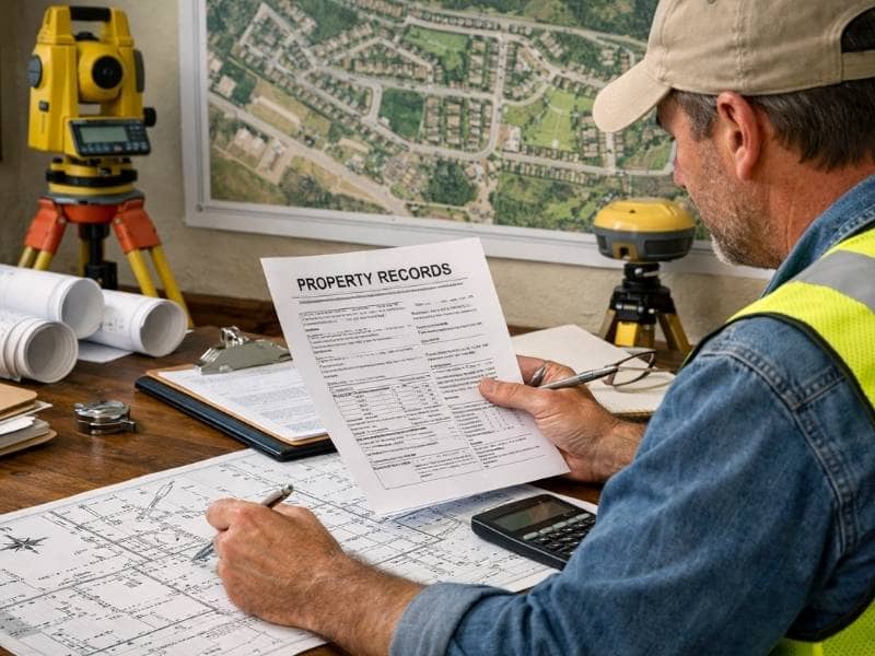
Land surveying involves far more than walking a property with equipment. Before a surveyor ever arrives on site, hours of research, record pulling, and planning have already taken place. Understanding what goes into the work makes the price make a lot more sense.
What Is the Average Land Survey Cost?
A standard residential boundary survey costs between $400 and $1,000 in most parts of the United States. Specialty surveys cost significantly more, often ranging from $1,500 to $5,000 or higher depending on complexity and location.
| Survey Type | Typical Cost Range |
| Mortgage/Location Survey | $300 to $700 |
| Boundary Survey | $400 to $1,000 |
| Topographic Survey | $500 to $1,200 |
| As-Built Survey | $700 to $1,500 |
| Construction Survey | $1,000 to $2,500 |
| ALTA/NSPS Survey | $2,000 to $5,000+ |
These are national averages. Prices in rural Alabama and other less populated areas may differ from larger cities due to local overhead, demand, and travel time.
What You Are Actually Paying For
Most people picture a surveyor walking around with a tripod for an hour or two. That fieldwork is only one part of the job. A land survey cost covers the entire process from start to finish.
Here is what goes into a typical survey:
- Research and record review. Before fieldwork begins, the surveyor pulls deeds, recorded plats, and prior surveys from county records. This step alone can take several hours on older or complicated properties.
- Field crew time. This includes travel to the site, equipment setup, taking measurements, and locating monuments or corner markers.
- Equipment use. GPS units, total stations, and data collectors are expensive tools that require regular maintenance and calibration.
- Office processing. After fieldwork, the surveyor calculates measurements, resolves any conflicts found in the records, and drafts the final plat.
- Professional certification. A licensed land surveyor’s signature and seal give the document legal standing. That credential comes with years of education, field experience, and a licensing exam.
- Professional liability insurance. Surveyors carry insurance that protects property owners if an error occurs. That coverage is factored into the cost of every job.
When you pay for a land survey, you are paying for a legally defensible document that can hold up in court. That is worth more than a few hours of field time.
What Drives the Cost Higher
Property Size
Larger properties take more time to measure and more fieldwork to complete accurately. A small subdivision lot is much faster to survey than a multi-acre rural tract with irregular boundaries. Most surveyors base their pricing on time and complexity, so bigger almost always means more expensive.
Terrain and Vegetation
A flat, open lot is straightforward to survey. A heavily wooded property, a hillside, or land near water creates real challenges. Thick vegetation blocks line-of-sight equipment readings. Uneven terrain requires additional setups and measurements to get accurate results. These conditions add hours to the job.
Age and Condition of Existing Records
Older properties with incomplete or poorly written deed descriptions require more research before fieldwork can begin. This additional office work is a legitimate part of what drives land survey costs higher, and it is often the factor homeowners least expect.
Properties that have never been surveyed before, or that were last surveyed decades ago, take longer to research. Deeds written in older formats, like metes and bounds descriptions using landmarks that no longer exist, require extra time to interpret and verify.
Missing or Destroyed Corner Markers
Corner markers are physical monuments placed in the ground to mark the boundaries of a property. When they are missing, buried, or destroyed, the surveyor cannot simply observe and record them. Instead, the boundaries must be located through research, calculation, and sometimes coordination with neighboring property records.
Re-establishing missing corners takes real expertise and adds measurable time to the job. It is one of the most common reasons a survey comes in higher than a homeowner expected.
The Type of Survey Required
Not all surveys serve the same purpose, and the differences in scope affect the price significantly. A mortgage survey provides a general location overview and is the least involved. A boundary survey is more precise and legally detailed. An ALTA/NSPS survey, which is typically required for commercial real estate transactions, is the most thorough and therefore the most expensive.
Paying for a survey type that does not match your actual need wastes money. Paying for one that falls short of what your situation requires can create problems down the road.
Location and Travel Time
Surveyors working in rural or remote areas often factor travel into their pricing. If your property is far from where the survey crew is based, that time and fuel cost gets reflected in the quote. A surveyor who already operates in your county or region will generally be more efficient and more competitive on price for local work.
Why Two Quotes Can Look Very Different
It is not unusual to get two quotes for the same property and see a significant difference between them. Several things explain this.
One surveyor may already have data from nearby surveys on file, which cuts down on research time. Another may be less familiar with the area and needs to start from scratch. One firm may include a stamped plat in the base price while another treats it as a separate charge. Experience level, crew size, and overhead costs also vary between companies.
Getting two or three quotes before hiring is a reasonable way to understand the local range. A quote that comes in very low deserves the same scrutiny as one that comes in very high.
Frequently Asked Questions
Why did my neighbor pay less for what sounds like the same survey?
Several factors could explain the difference. Their lot may be smaller, flatter, or easier to research. A recent nearby survey may have already established some of the boundary points. Prices also change over time, so surveys completed years apart will reflect different rates.
Does the land survey cost include a copy of the plat?
Not always. Some surveyors include a certified plat as part of their standard fee. Others charge separately for a stamped or recorded copy. Asking about this before signing any agreement avoids surprises at the end.
Is a lower-priced survey less accurate?
Price alone does not determine accuracy. A licensed surveyor who is familiar with your area and charges less than a competitor can produce work that is just as accurate. What matters most is that the surveyor holds a valid state license and carries professional liability insurance.
Does providing an old survey lower the cost?
It can. Sharing any existing surveys, deeds, or plats with the surveyor before work begins reduces the time spent on research. Less research time can translate directly into a lower quote.