
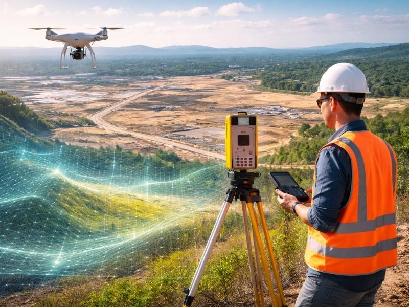
Most people have never heard of LiDAR mapping until they need it. Then they need it badly. Developers, engineers and surveyors use it to get elevation data, terrain models and surface measurements that traditional methods can’t match for speed or detail. This article breaks down what LiDAR mapping is, how it works and where it fits into real-world projects.
The Technology Behind the Name
LiDAR stands for Light Detection and Ranging. It’s a remote sensing method that uses laser pulses to measure distances between a sensor and the ground below. Those measurements get processed into highly accurate three-dimensional models of terrain, structures and surfaces.
The output is called a point cloud. Imagine millions of individual data points, each one representing a precise location in three-dimensional space. When those points are stitched together, you get a detailed picture of whatever the laser scanned.
Drone LiDAR is not photography. It doesn’t capture color or texture the way a camera does. It captures geometry. That distinction matters a lot when you’re planning a construction project or assessing land for development.
From Laser Pulse to 3D Model
A LiDAR system fires laser pulses at a surface. Each pulse travels to the target, bounces back and returns to the sensor. The system measures how long that round trip takes. Since light travels at a known speed, the system calculates the exact distance to that point.
This happens thousands of times per second. A single pass over a project area can generate hundreds of millions of data points. The result is a dense, accurate model of everything the laser hit.
Most LiDAR systems also record multiple returns from a single pulse. When a laser hits a tree, it might bounce off a leaf first, then a branch, then the ground below. Each return gets recorded separately. This is how LiDAR can see through vegetation to capture the bare ground underneath, which is something aerial photography simply cannot do.
What Comes Out of a LiDAR Survey
Raw LiDAR data gets processed into several deliverables depending on what the project needs.
A Digital Elevation Model (DEM) shows bare-earth terrain after vegetation and structures have been filtered out. It’s the go-to product for flood analysis, grading plans and drainage studies.
A Digital Surface Model (DSM) includes everything the laser hit, including trees, buildings and other features above ground. It gives you a picture of the surface as it exists, not just the ground beneath it.
A Digital Terrain Model (DTM) is similar to a DEM but often includes additional breaklines and contours manually added by a surveyor to improve accuracy in critical areas.
Contour maps are generated directly from LiDAR data and used in site planning, civil engineering and construction documents.
Point clouds themselves are sometimes delivered directly to clients for use in design software.
Where LiDAR Makes the Most Sense for Developers
LiDAR isn’t the right tool for every job. For a small residential lot, a traditional ground survey is faster and cheaper. But for larger, more complex projects, LiDAR saves significant time and money.
It performs well on large tracts of undeveloped land where ground crews would take weeks to cover the same area. Heavily wooded sites benefit from LiDAR’s ability to filter vegetation and expose the ground below. Projects near waterways or in flood-prone areas use LiDAR elevation data to feed hydraulic models and support permitting.
In Decatur and across northern Alabama, land development along river corridors and in floodplain areas makes LiDAR particularly useful for accurate elevation data and drainage planning.
Numbers Worth Knowing
Modern airborne LiDAR systems can collect between 200,000 and over one million points per second depending on the sensor.
Typical accuracy for airborne LiDAR in open terrain is 10 to 15 centimeters vertically. Ground-based systems can achieve accuracy under one centimeter.
The United States Geological Survey (USGS) 3D Elevation Program (3DEP) has collected LiDAR data covering more than 80 percent of the contiguous United States.
LiDAR point density for standard topographic mapping is typically two to eight points per square meter. High-density collections can exceed 20 points per square meter.
Alabama has LiDAR coverage available through the USGS 3DEP program, with varying resolution depending on the county and collection year.
Frequently Asked Questions
What is LiDAR mapping and what is it used for?
LiDAR mapping is a remote sensing method that uses laser pulses to measure distances and create three-dimensional models of terrain and surfaces. Developers and engineers use it for site analysis, flood modeling, terrain mapping and construction planning on projects where traditional ground surveys would be too slow or costly.
How accurate is LiDAR survey data?
Accuracy depends on the system type and collection method. Airborne LiDAR typically achieves vertical accuracy of 10 to 15 centimeters in open terrain. Ground-based terrestrial LiDAR can achieve accuracy under one centimeter. Project specifications and intended use determine which accuracy level is needed.
What is a point cloud in LiDAR?
A point cloud is the raw output of a LiDAR scan. It’s a collection of millions of individual data points, each with a precise three-dimensional coordinate. Point clouds are processed into elevation models, contour maps and other survey products used in engineering and planning.
Can LiDAR see through trees and vegetation?
Yes. Because LiDAR records multiple returns from a single laser pulse, it can capture the ground surface beneath a tree canopy. The first return hits the top of the vegetation and later returns penetrate to the ground below. This makes LiDAR useful on wooded sites where aerial photography can’t capture bare-earth elevations.
How is LiDAR different from traditional land surveying?
Traditional ground surveys use direct measurement by a field crew. LiDAR collects data remotely using laser pulses, covering large areas much faster. Ground surveys are more precise for individual points and legal boundary work. LiDAR excels at large-area terrain modeling, volumetric analysis and projects where speed and coverage matter more than individual point precision.